Vortigern
Studies Index


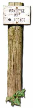
.Wansdyke Project 21
is part of
Vortigern Studies

|
|
Section 9:
Milk Hill
to Shaw House
Wiltshire |
  |
| |
click here for directions to
Section 9 |
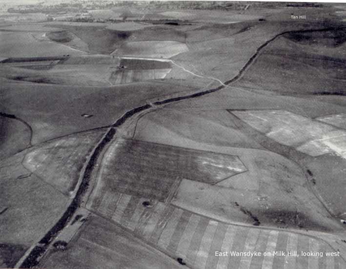
East
Wansdyke at Milk Hill (click here to
enlarge), looking west to Tan Hill. Wansdyke
is running across the southern escarpment of the
Marlborough Downs, with the Vale of Pewsey in the
background.
|
|
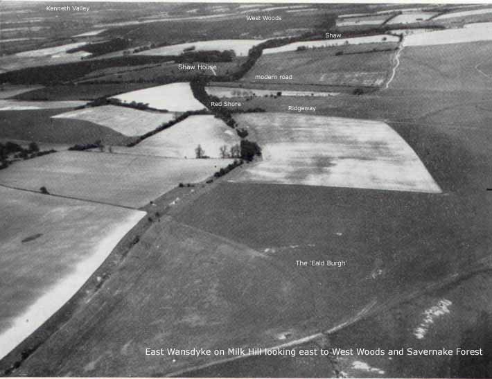
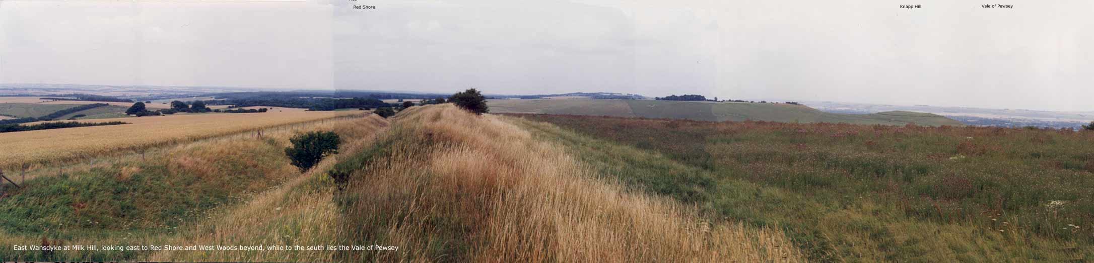
East Wansdyke
at Milk Hill (click here to
enlarge), looking east to West Woods and
Savernake Forest. Clearly visible is Red Shore,
where the ancient Ridgeway passes through
Wansdyke, with the modern road beyond. |
 Wansdyke was mentioned by name (Wodnes
Dic) in three Anglo-Saxon charters recording royal
grants of land in Stanton St. Bernard to Ordlaf
(AD 905) and the Bishop of Ramsbury (AD 957 and 960).
From the shoulder of Milk Hill, Wansdyke passes north of
two more ancient features mention in these charters, Oxna
mere (a pond) and Eald Burh (the 'Old
Castle'). An older charter of the ninth century,
mentioning Wansdyke along the Alton Priors – Alton
Barnes boundary, referred to thaere Ealdan Dic
(the 'Old Ditch'). Wansdyke was mentioned by name (Wodnes
Dic) in three Anglo-Saxon charters recording royal
grants of land in Stanton St. Bernard to Ordlaf
(AD 905) and the Bishop of Ramsbury (AD 957 and 960).
From the shoulder of Milk Hill, Wansdyke passes north of
two more ancient features mention in these charters, Oxna
mere (a pond) and Eald Burh (the 'Old
Castle'). An older charter of the ninth century,
mentioning Wansdyke along the Alton Priors – Alton
Barnes boundary, referred to thaere Ealdan Dic
(the 'Old Ditch').
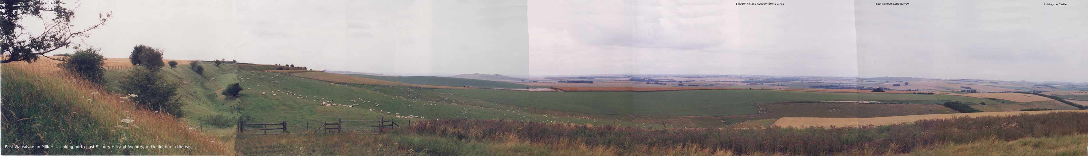
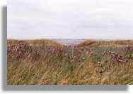
This spread
(click here to enlarge), shows East
Wansdyke on Milk Hill, with the view north to the Kenneth
Valley during my visit in 1996. Directly north are
Sillbury Hill and Avebury Stone Circle.
At this point, the soil
changes, and Wansdyke is tree-covered for the remainder
of its course through arable downland up to Savernake
forest.
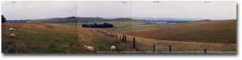
This spread
(click here to enlarge), shows East
Wansdyke on Milk Hill, looking east and from left to
right to the Kenneth Valley across the West Woods to the
Vale of Pewsey, 1996.
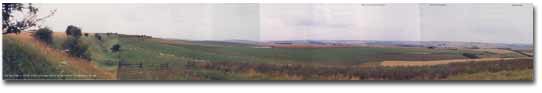
This rotating
panorama, shot by Pete Glastonbury, also shows East
Wansdyke on Milk Hill, looking east and from left to
right to the Kenneth Valley across the West Woods to the
Vale of Pewsey, 2002.
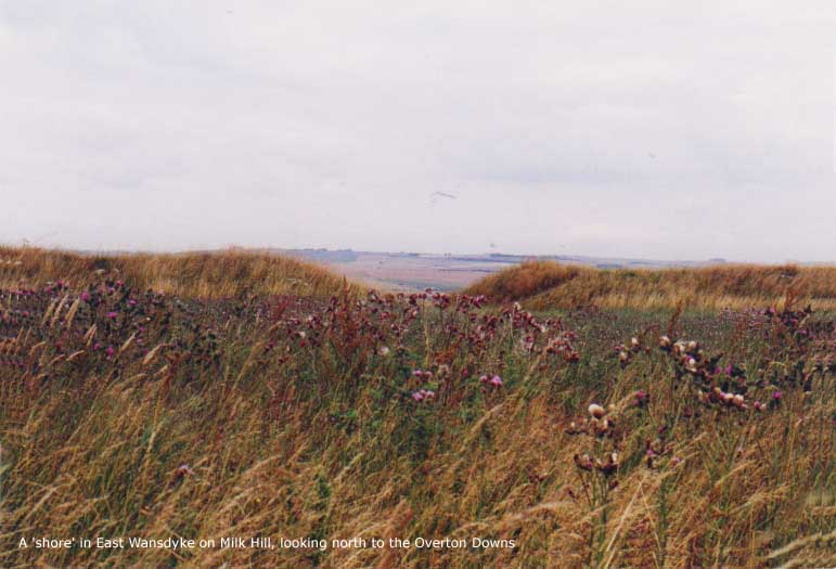
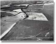
 At Red Shore, thus called for the red
soil, Wansdyke is crossed by the ancient Ridgeway. This
is now a drove-road (where cattle was driven across from
the farms to the markets or from pasture to pasture), but
in early times it was a long-distance route from the
Dorset coast to the Norfolk coast, maybe even as far back
as prehistoric times down to the end of the Middle Ages.
The above ninth-century charter mentioned it as thaet
Riad Geat (The Red Gate), now called Red Shore.
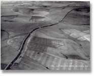
Today, the Ridgeway Long Distance Path still uses this
ancient site, which is unfortunately densely overgrown,
as can be clearly seen from the 1956 airshot above right. At Red Shore, thus called for the red
soil, Wansdyke is crossed by the ancient Ridgeway. This
is now a drove-road (where cattle was driven across from
the farms to the markets or from pasture to pasture), but
in early times it was a long-distance route from the
Dorset coast to the Norfolk coast, maybe even as far back
as prehistoric times down to the end of the Middle Ages.
The above ninth-century charter mentioned it as thaet
Riad Geat (The Red Gate), now called Red Shore.
Today, the Ridgeway Long Distance Path still uses this
ancient site, which is unfortunately densely overgrown,
as can be clearly seen from the 1956 airshot above right.
Wansdyke now crosses a
dry valley where the West Overton – Alton Priors
road runs through. This was called Wodnesdene (Woden’s
Valley) in a charter of AD 939, and a great boulder
marked the boundary here:
Thonon on otherne
Micelne Stan on tham Wege middan on thaere DaeneBythan
the ligeth ut on Woddes Geat.
A great stone lying on
the track in the middle of the bottom of the dene that
runs to 'Wodens gate'.
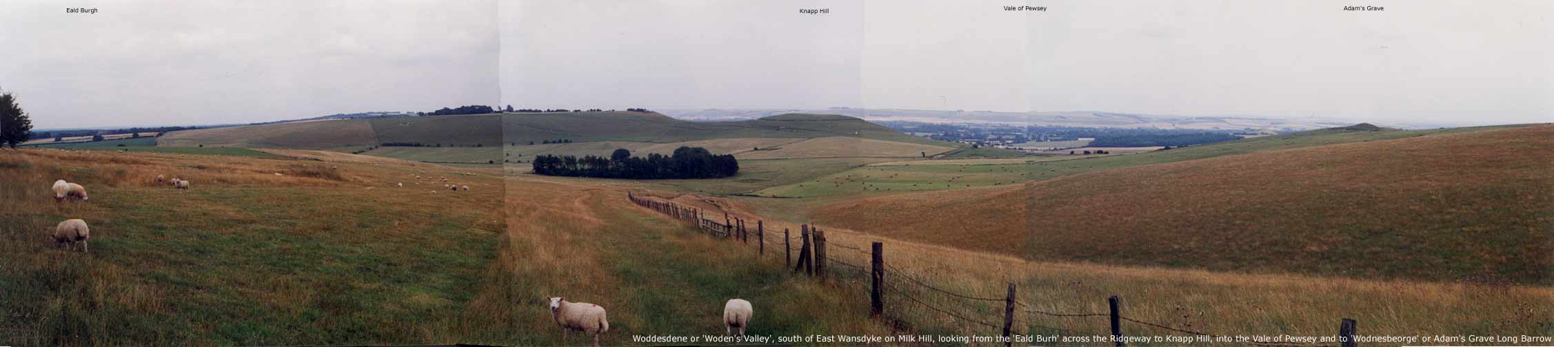
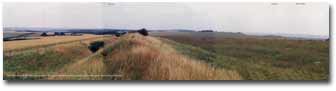
This spread
(click here to enlarge), shows Milk Hill
south of Wansdyke, looking across the dry valley once
known as 'Woden's Valley'. Looking left to right are the
Old Burgh, the Ridgeway crossing behind the trees, Knapp
Hill and right Adam's Grave. This neolithic long barrow
was once called Woden's Barrow, and a battle was fought
here in Ad 594 and again in AD 715. In the background
lies the Vale of Pewsey, behind which rises Salisbury
Plain.
Given the name of a
great tumulus nearby (Wodnes Beorge/Woden’s
Barrow), Wansdyke crossing this valley called Woden’s
Dene, it seems fair to assume that Woden’s Gate
was the gap in Wansdyke where the road ran through.
According to Fox & Fox, the boulder was therefore to
be found along the modern road, where they thought to
place Woden’s Gate. However, this rock, measuring
3x6x2 ft., is surely placed where the Ridgeway crosses
Wansdyke at Red Shore (as reported by Burrow)! Therefore,
either Red Shore may be a better candidate for
Woden’s Gate thyan the modern road passing near Shaw
House, or we must look even further south, the point
where all roads meat and descend the southern escarpment.
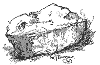
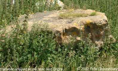
Hammer-shaped
stone, found where the Ridgeway crosses Wansdyke.
The picture was drawn in 1925.
|
|
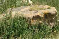
Most
likely the same stone in 2002, turned on its
side. (click here to enlarge)
|
Wansdyke,
now overgrown for the remainder of its track to savernake
Forest, passes Shaw House, where it diminishes greatly in
size.
Directions
to Section 9 can be found here.
Follow
Wansdyke further through Section 10
Bibliography 
- Burrow, Edward J. (1926): From Morgan's
Hill to Savernake, in: Major and Burrow: The
Mystery of Wansdyke, pp. 92-105.*
- Crawford, O.G.S. (1960): Archaeology in
the Field, (London).*
- Fox, Cyril and A. Fox (1958): Wansdyke
reconsidered, in: Archaeological Journal 115,
pp. 1-48.*
|