Vortigern
Studies Index


.Wansdyke Project 21
is part of
Vortigern Studies

|
|
A
Visit to Wansdyke - Shaw House
 My second visit to Wansdyke after 1989 went My second visit to Wansdyke after 1989 went  by almost as quick as the first
one. This time, my girlfriend and I were better prepared,
we had Ordnance Survey Landranger maps and we brought
some good guides of the region along. Not only is the
cycling much easier using these, when you prepare
properly there's no monument that's not on the map! by almost as quick as the first
one. This time, my girlfriend and I were better prepared,
we had Ordnance Survey Landranger maps and we brought
some good guides of the region along. Not only is the
cycling much easier using these, when you prepare
properly there's no monument that's not on the map!
In fact,
this trip was meant to make up for some of the stupid
mistakes of three years back. But alas, this september
was not to be compared to that fine August three years
ago!
Starting
in Oxford, we soon found this trip much harder
than the first. August had been wet already, but
by september it was even colder - no reprive as
we had hoped for! We did not actually ditch our
tent (but we came close),
|

click to
enlarge
|
but
struggling from one B&B to another in heavy
traffic we vowed early on that this would be the
last cycling holiday we'd ever make.. But is
wasn't all bad. Though stranded in Uffington (no
B&B) we were rescued (thanks Sue!)
|
  and
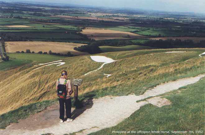
the afternoon turned out to be one of the best when we
visited the Uffinton White Horse and its beautiful views
of the Thames Valley. and
the afternoon turned out to be one of the best when we
visited the Uffinton White Horse and its beautiful views
of the Thames Valley.
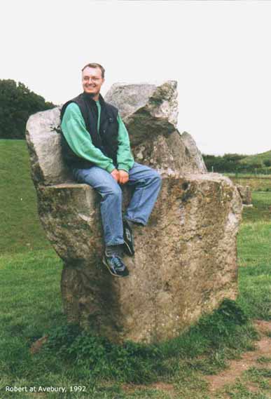
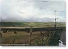
This time
though we did at least find Avebury, which we liked
better than Stonehenge (in fact we still do), and we had
a lot of fun roaming this ancient site (click here to enlarge), which is so large
but accessible and mysterious. This time, we actually
sought out where to cross the Downs for the best view of
Wansdyke. Which was at this point (left).
Unfortunately,
the bank of Wansdyke is beset with large trees which
obscure the view of Dyke from 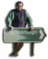 view from a point only about a
mile west.The road, which crosses the Downs from the
Kenneth Valley to the Vale of Pewsey uses the only
original crossing-point, also used by the Ridgeway, a
very ancient road that runs from Salisbury plain towards
the north east until it reaches the North sea in Norfolk. view from a point only about a
mile west.The road, which crosses the Downs from the
Kenneth Valley to the Vale of Pewsey uses the only
original crossing-point, also used by the Ridgeway, a
very ancient road that runs from Salisbury plain towards
the north east until it reaches the North sea in Norfolk.
But at this
point the soil changes, and because of that the forest
starts here. Anyway, the Downs are very beautiful here so
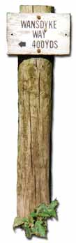
we carried on cheerfully, despite this setback. So, this
little sign along the small road was all we saw of
Wansdyke...
 That
is, apart from a quick look back on our way to shelter in
a pub! That
is, apart from a quick look back on our way to shelter in
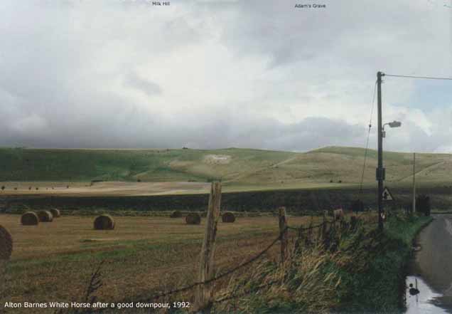
a pub!  Hardly had we
survived the very steep descent towards Alton Barnes,
when the weather took a turn for the worse, and the rain
hit us as soon as the hills were behind us (click here to enlarge). This picture of the
Alton Barnes White Horse shows both the vengeance from
the skies and the difference with the pleasant ride three
years back. Hardly had we
survived the very steep descent towards Alton Barnes,
when the weather took a turn for the worse, and the rain
hit us as soon as the hills were behind us (click here to enlarge). This picture of the
Alton Barnes White Horse shows both the vengeance from
the skies and the difference with the pleasant ride three
years back.
Luckily,
there was a great pub ('The Barge Inn') situated next to
the Kenneth & Avon Canal, which served great food and
drink to get over such setbacks.
 Yes, this year we did make it to
Glastonbury, and wouldn't have missed it for the world! ,
but we were rai Yes, this year we did make it to
Glastonbury, and wouldn't have missed it for the world! ,
but we were rai n-soaked a little too often for
comfort. Yes, I know that sounds like we have the
endurance of wet towels, but I like to enjoy the views on
a trip, not the sweat.. The much heavier traffic made us
seek out the back roads, and these tend to be a lot
steeper. Although the views were beautiful, coming down
from the Mendips escarpment following a small road from
Shepton Mallet into the Somerset Levels, we were glad to
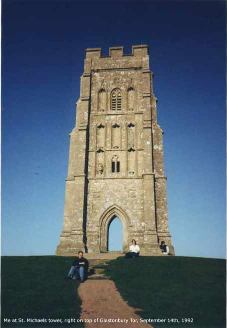
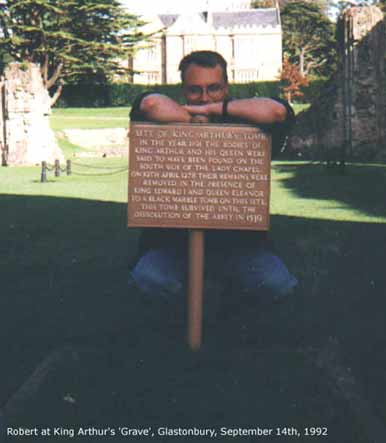
have reached our goal. Glastonbury was a real
refreshment, with so much Arthurian going on - real or
not, who cares? The Abbey with the gravesite (right,
click here to enlar n-soaked a little too often for
comfort. Yes, I know that sounds like we have the
endurance of wet towels, but I like to enjoy the views on
a trip, not the sweat.. The much heavier traffic made us
seek out the back roads, and these tend to be a lot
steeper. Although the views were beautiful, coming down
from the Mendips escarpment following a small road from
Shepton Mallet into the Somerset Levels, we were glad to
have reached our goal. Glastonbury was a real
refreshment, with so much Arthurian going on - real or
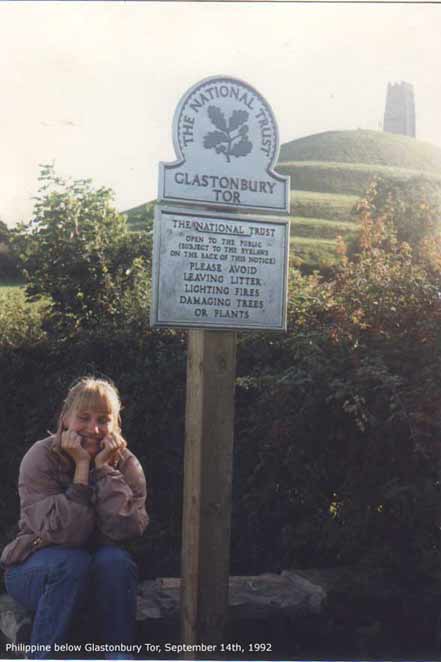
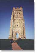
not, who cares? The Abbey with the gravesite (right,
click here to enlar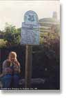 ge) is beautiful, the Tor (left
and below right, click here and here to enlarge) mysterious and
blessed with such good views all around you'd want to
visit Glastonbury just for that. ge) is beautiful, the Tor (left
and below right, click here and here to enlarge) mysterious and
blessed with such good views all around you'd want to
visit Glastonbury just for that.
After a
short stay we made it to South Cadbury (Camelot?) after
which we struggled on to Salisbury, but from there we
took the bus to Stonehenge and then the train back to
London. Indeed no more bikes! Better luck next time? We'd
see about that, two years on, and by car.
|